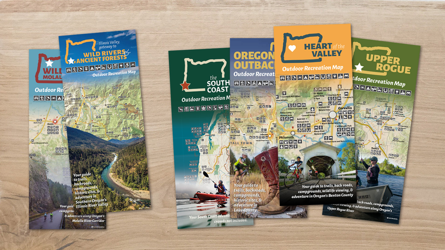
What kind of map person are you? Do you love a digital map, a guidebook map, a giant paper map that takes precision skills to fold back together correctly? Whatever your preference, accuracy is key. That’s why Travel Oregon has worked with local land managers and regional partners to develop the Outdoor Recreation Map program — as a tool for trip-planning and adventuring safely across the state, including highly remote areas.
You can use these maps for much more than getting from Point A to Point B. Each map is a blueprint and inspiration guide for all you need to know about your journey, including where to stay, shop and dine. You’ll find tips on how to visit responsibly and how to get the most out of each visit, whether it’s adding on a guided tour or finding a farmers market you might not have known about.
Find the collection of free maps below (click on the destinations to download and print), or at Travel Oregon’s eight staffed Welcome Centers. You can also pick one up at hundreds of other locations across the state including select hotels, attractions, Interstate-5 rest areas and more. The maps will be updated annually, so you’ll have the latest info. However because many of these areas are so vast, the maps can’t detail it all. Always be sure to search local destination and land manager websites for more details.
You’re one step closer to taking that trip — now all you need to do is wrangle the crew.
1. Hells Canyon & Wallowa Mountains
Eastern Oregon
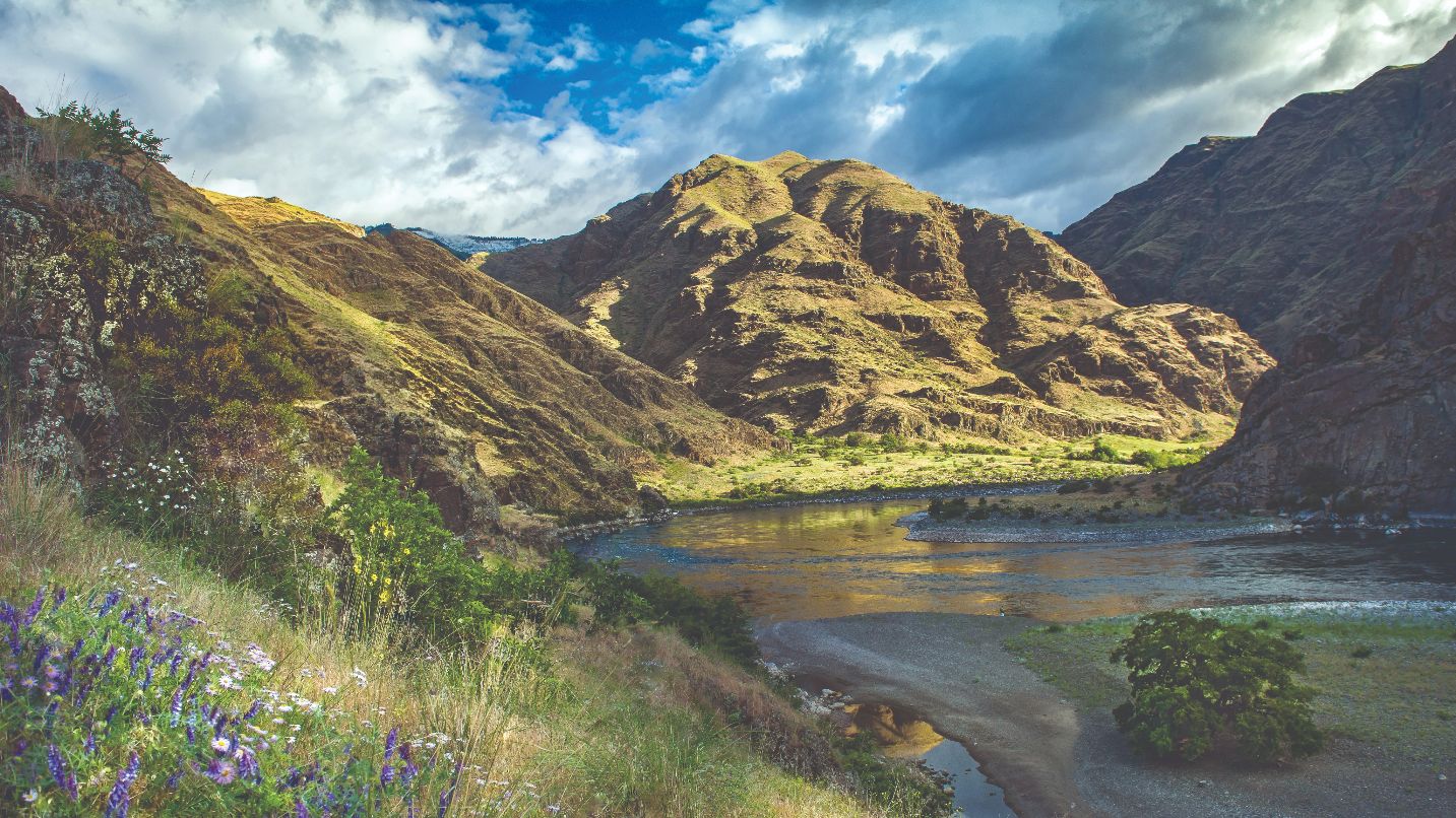
Welcome to Oregon’s northeastern corner, home of North America’s deepest canyon, where the wild Snake River carves its way through the Hells Canyon wilderness. The 7,200-foot-deep canyon was hewn through ancient metamorphosed rocks and Columbia River basalts by the force of the Snake River and the powerful Ice Age flood. You’ll find gold mines, ghost towns, rivers to float, lakes to fish, summer solitude and a winter wonderland in this quiet refuge. The communities of Baker City and Joseph are bustling with ways to celebrate history and the arts. Wallowa Lake and the Eagle Cap Wilderness are the just two of the natural treasures here, with endless opportunities to hike, paddle and camp amidst jaw-dropping geology.
Getting There
The Hells Canyon Scenic Byway is about four hours east of Portland. You can also fly to Pendleton and rent a vehicle. Along Highway 82, winding trails, lush valleys and Wallowa Lake await. Highway 86 offers grasslands, mountain views and access to Hells Canyon. Know that the narrow USFS Road 39 has sharp curves, steep drop-offs, a 6,000-foot-high pass, no cellphone service and it’s also closed by snow from late October through May. Watch for wildlife and livestock on all roads, especially in May and June and in the fall. Find EV charging stations in Baker City, La Grande and Enterprise. The Grande Ronde Farm Trail is a self-guided blueprint for food and farm adventures along the way, where you can pet baby goats, pick up grass-fed beef and local veggies and more. Make sure to confirm hours in the winter before you go.
When to Visit
Spring is often chilly and wet and summers hot and dry, punctuated by awe-inspiring thunderstorms. The tawny grasslands begin to turn green in April; mid-May through late June offer optimal birding and wildflowers. It’s important to watch for wildfire smoke in the area July through September — make sure you travel with sunscreen, extra water and a shovel to extinguish campfires if they are allowed. October, with crisp, fall days, brings colors to mountains and valleys alike. Cool fall weather lasts through November. Winters, including February and sometimes early March, are cold and snowy, great for skiing, snowshoeing and sledding, as well as the Eagle Cap Extreme dog sled races in late January.
2. Oregon’s Outback
Southern Oregon
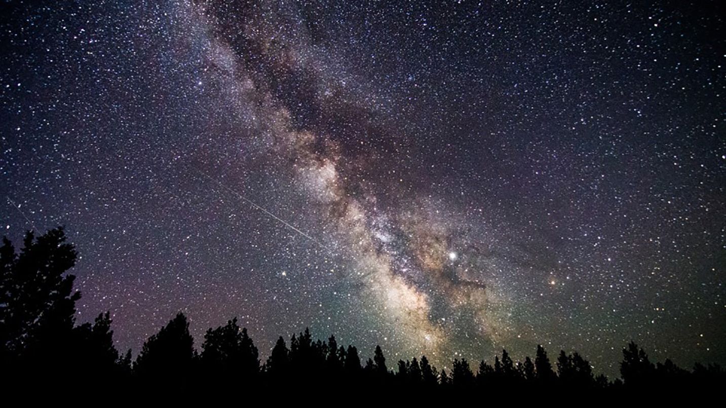
Oregon’s Outback is a vast arid region east of the Cascade Range. It encompasses over 8,000 square miles and is a place of extremes including the largest geyser in Oregon (Old Perpetual in Lakeview, at 200 feet high) and the largest inland sand dunes in the Pacific Northwest (Christmas Valley Sand Dunes). You also won’t want to miss Hart Mountain National Antelope Refuge, Summer Lake Hot Springs, Fort Rock State Natural Area and the Oregon Timber Trail for 670 miles of backcountry mountain biking. People come to this high-desert landscape to get away from it all, and especially to experience some of the most pristine starry skies in North America. While it’s an outdoor playground by day, at night you can stargaze in this Oregon Outback International Dark Sky Sanctuary — a total of 2.5 million acres of land located within the largest contiguous pristine dark-sky zone in the lower 48 states.
Getting There
The closest major cities to the Oregon Outback are Bend and Klamath Falls, both 1.5 hours away. You’ll likely travel via the Oregon Outback Scenic Byway from La Pine to Lakeview, Highway 395 from Burns south or Highway 140 from Klamath Falls east to Hart Mountain and beyond. The Redmond and Medford airports are convenient ways to arrive by plane.
When to Visit
The Oregon Outback is located in a rain shadow, so there’s little rainfall and cloud cover during the summer months. That makes for a spectacular desert landscape but also one that’s best visited in spring and fall, so you can avoid active adventuring in extreme heat in July and August. The region often sees snow from late October through mid-June in the higher elevations — a great time to try snowshoeing, cross-country skiing, snowmobiling or the chairlift at Warner Canyon Ski Area.
3. South Coast
Oregon Coast
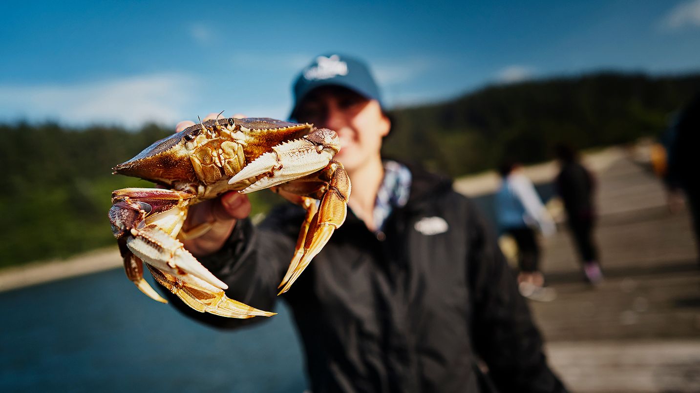
This beautifully uncrowded and rugged stretch of Oregon coastline — comprising the 134 miles between Reedsport and Brookings, at the state’s southern border — is nicknamed the Wild Rivers Coast, for good reason. Here you’ll find easy access to a number of nationally designated Wild and Scenic rivers including the Elk, Illinois and Chetco. Visitors can enjoy year-round fishing, boating, cycling, hiking, birding, windsurfing, beachcombing and more. The South Coast is also famous for its culinary bounty — from fresh, local Dungeness crab to Oregon rockfish, cranberries, salmon and sweets. Find it all on the self-guided Wild Rivers Coast Food Trail, but be sure to call before you visit in the winter months.
Getting There
Reedsport is the gateway to the South Coast, 1.5 hours from both Eugene and Roseburg. Travelers can take Oregon Highway 38 to the Coast and head south on Highway 101 for some of the most scenic views anywhere, with sea stacks, rock arches, lighthouses, coastal bluffs and forests all around. If you’re going to pull off the highway for photos, do so safely at designated viewpoints.
When to Visit
The South Coast is moderate all year-round, with the winter months being a bit rainier. Dogs and beaches go hand in hand, but before you bring your furry friends to the beach it’s important to check that location’s specific rules. Be especially aware that March 15 to September 15 is snowy plover nesting season on the Coast, so certain areas are protected for the health of the wildlife and ecosystems. Abide by all posted signs.
4. Wild and Scenic Molalla Corridor
Willamette Valley
Welcome to Molalla — a small town surrounded by big fun. Here you can experience more than 20 miles of trails for hiking, biking, kayaking, horseback riding and wildlife watching in the Molalla River Recreation Area. You can connect with local history at the century-old Molalla Buckeroo or stroll the walkable downtown, where eateries, coffee shops and local boutiques await. Adventurers won’t want to miss the Wild and Scenic Molalla River or hiking to the sweeping summit of Table Rock, the lone remnant of a lava flow that once covered the entire region. You may also want to tour a hazelnut farm, sip wine at a vineyard or pet a fluffy alpaca along the South Clackamas Farm Loop, a self-guided route for farm-based adventures.
Getting There
Surrounded by forests and farmland, Molalla feels very much off the beaten path, despite being 45 minutes from downtown Portland and 45 minutes from Salem. There are two corridors into town: Oregon Highway 213 runs north-south and Oregon Highway 211 runs east-west.
When to Visit
Molalla sits in the foothills of the Cascade Range and enjoys a mild climate all year long, with rain showers (and possibly a few snow flurries) between October and April. If you’re traveling during winter know that some farms and destinations may be closed to visitors, so be sure to check before you go. May through September it can get hot, so be sure to bring sunscreen and plenty of water.

5. Upper Rogue
Southern Oregon
The 60-mile stretch of the Rogue River between Crater Lake National Park and the Upper Wild & Scenic Rogue River corridor is known as the Upper Rogue. Starting in wine country near Gold Hill and Medford, you’ll wind along steelhead-filled stretches of the Rogue River to visit family-run wine-tasting rooms and Lost Creek Lake. You’ll wind past Prospect, where Mill Creek and Pearsony waterfalls plunge into the Rogue, and journey along the Rogue-Umpqua Scenic Byway into the rugged headwaters of the Rogue River at Union Creek. Don’t miss the some of the best whitewater rafting, hiking, paddling, fishing and golf in the state.
Getting There
You can reach the Upper Rogue both from the north and the south via the Rogue-Umpqua Scenic Byway, or via Interstate-5 from the cities and communities of Medford, Gold Hill and Rogue River. It’s also a breeze to fly into the Medford airport or hop aboard Amtrak’s Coast Starlight train, which stops in Klamath Falls. Here you can rent a car to drive the Upper Rogue loop on your way to visiting Crater Lake.
When to Visit
The lower elevations of the Rogue Valley near Gold Hill and Eagle Point have the full range of seasons: rain comes between November and March, while the summers are hot and dry. Be sure to pack sunscreen and plenty of water during the summer months. At high elevation near Crater Lake, expect snow as early as September and well into June. Park access along these mountain roads may not be maintained in winter.
6. Harney County High Desert
Eastern Oregon
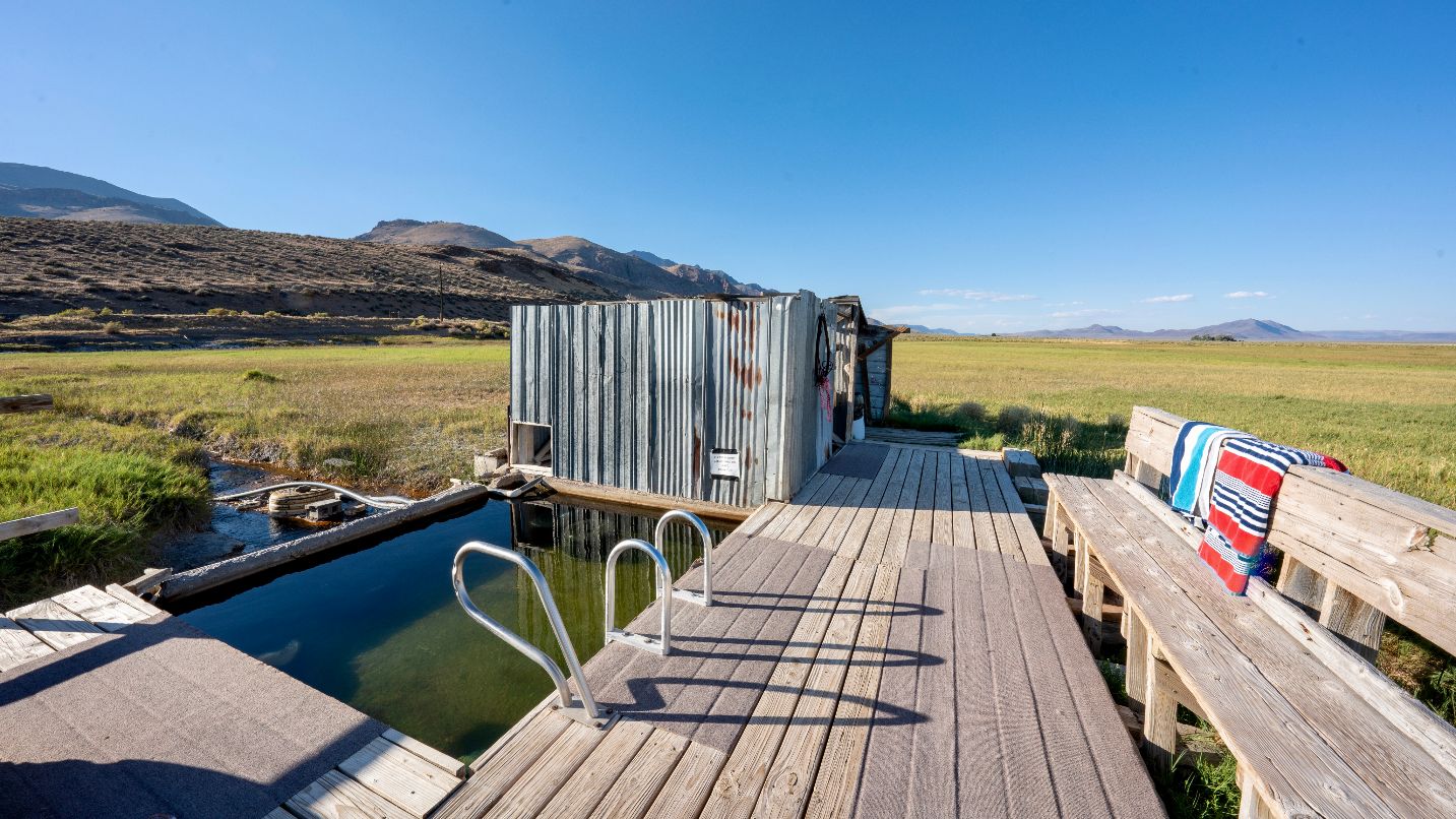
Welcome to the southeastern corner of the state, a high-desert open-range county where cattle outnumber people 14 to one. The diverse geography here includes dense forests, ancient lava beds and dry lake beds — most famously the Alvord Desert, where you can fly a kite, ride a bike and get an epic selfie as you marvel at the sheer beauty. You can stay overnight and soak in the hot springs, or relax at any of the other hot springs of Southeastern Oregon. The Malheur National Forest is a must-visit for outdoors-people, where you can camp, hike, fish and watch the bird migration along the Pacific Flyway in spring, when over 300 species make their annual migration across the Harney Basin. Many travel to this area specifically to hike or take scenic drives along Steens Mountain, a remote wonderland where you are truly getting away from it all.
Getting There
Accessible by highways from any direction, Harney County high desert is about 3 hours southeast of Bend, 4.5 hours south of Pendleton and 6 hours southeast of Portland. While there are small towns throughout the county including Burns, Hines, Frenchglen, Crane and Fields, it’s important to be prepared for long distances between services and amenities. Depending on the time of year, small stores may not yet be open for the season. Cell service can be spotty or non-existent. Travel with detailed maps (pre-downloaded or detailed paper maps) of the areas you wish to explore, and bring extra supplies.
When to Visit
Harney County is known for its long winter — expect snow and wintry conditions to start early in fall and linger late into spring. Be prepared with proper traction tires as suggested or required, and know how to use them. Some roads may not be maintained during the winter. Spring through fall, you may encounter a traffic jam on roadways when cattle are moved to better foraging areas, so drive slowly and cautiously. Summer is typically hot and dry — carry extra water, sunscreen and a fire tool, like a small shovel. Wildfire risks change quickly, so check before you go.
7. Illinois Valley
Southern Oregon
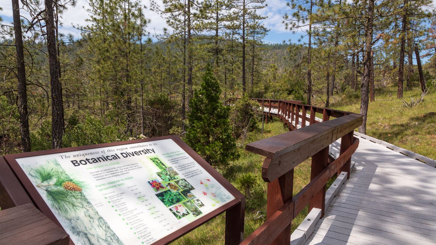
The Illinois Valley is area south of Grants Pass and down to Oregon’s southern border. The Illinois River flows through the area just north of Cave Junction, creating a patchwork of wild beauty including the Kalmiopsis, Siskiyou and Red Butte wilderness areas. Visitors will want to see the century-old Oregon Caves National Monument & Preserve, where you can tour the marble halls, camp and hike with a ranger. Eight Dollar Mountain Botanical Wayside is a top spot for plant lovers, with an easy walk through towering pines to view one of the region’s most unique botanical features, the carnivorous California pitcher plant.
Getting There
This area is easily accessible by Highway 199, also known as Redwood Highway, which runs north-south. It’s a short drive from Grants Pass and the Medford airport. As with other remote areas, off-the-beaten-path areas of Oregon, it’s wise to come prepared with travel supplies, expect spotty cell coverage and carry your Ten Essentials for hiking when out adventuring.
When to Visit
The spring season brings showers, which keep the valley green. April and May are prime for viewing rare wildflowers. Summer days June through September are dry and warm, but temperatures can drop drastically at night, so bring layers. Be aware of area wildfires that can inundate the valley with smoke through September. Fall brings warm days, cool nights and eventually, rain. Winters are generally mild but very wet. If you visit in winter, expect snow at higher elevations and be sure to check road conditions.
8. Heart of the Valley
Willamette Valley
You may not have heard of Benton County, in the heart of the Willamette Valley — but that’s what makes it so special. This area is home to so many marvels that rightly put it on any must-visit Oregon adventure list. Marys Peak is the tallest peak in the Oregon Coast Range, a regional icon that you can hike, bike or visit for a picnic and sunset views. Alsea Falls Recreation Site is home to the area’s signature waterfall, with trails, a campground and more in the lush foothills of the Coast range. The Corvallis-to-Sea Trail is a newish backpacking and bikepacking route that heads 60 miles from Corvallis to the Pacific Ocean, through rural communities, farms, forests and more. The Willamette Water Trail and wine tasting at some of the valley’s top wineries are also favorite pastimes.
Getting There
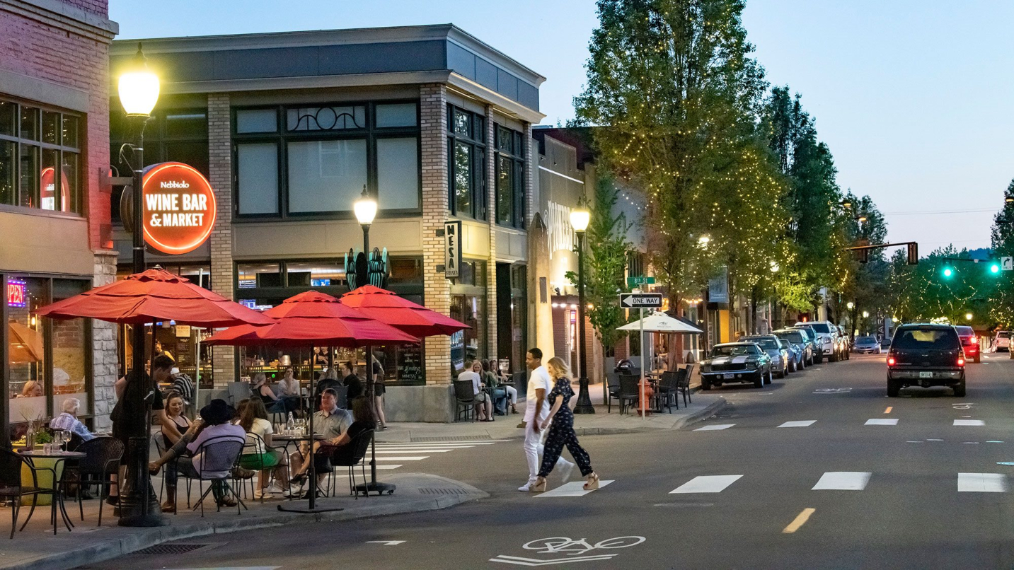
Corvallis, Philomath and the other friendly communities here are a bit off the beaten path, just west of Interstate-5 and about an hour south of Salem. Corvallis is home to Oregon State University, with a bustling downtown along the Willamette River and abundance of lodging, shops and world-class dining. It’s easy to visit as a day trip from Portland, but a few days is ideal if you want to fully experience all the region has to offer. If you’re going carless, find easy shuttle transportation to and from Portland by companies like Groome Transportation and FlixBus, or you can fly into Salem and rent a car.
When to Visit
Corvallis the surrounding area sit in the foothills of the Cascade Range and enjoy a mild climate all year long, with rain showers (and possibly a few snow flurries) between October and April. If you’re traveling during winter know that some farms and destinations may be closed to visitors, so be sure to check before you go. May through September it can get hot, so be sure to bring sunscreen and plenty of water.
9. Clackamas River
Mt. Hood/Columbia River Gorge
The Clackamas River starts on the slopes of Olallie Butte in the Cascade Range and winds through the Mt. Hood National Forest, passing through several communities, before emptying into the valley 83 miles later at Oregon City. While Indigenous people have used the river since time immemorial, today locals and visitors alike visit the river and its communities for outdoor recreation all year-round. The upper Clackamas River (from the headwaters to Estacada) are for thrilling whitewater trips, while the lower Clackamas (Estacada to Oregon City) are for mellow river floats, fishing, boating and camping. Along the river you can also find plentiful trails for hiking and biking, disc-golf courses, forests for mushroom foraging and vibrant cities for shopping, dining and craft beer, wine and cider tasting.
Getting There
The Clackamas River communities are about 30 minutes southeast of Portland, an easy drive along Highway 224. Check out the friendly outposts of Ripplebrook, Barton, Carver, Gladstone, Oregon City and Estacada, each with their own attractions. Great stops include the Bagby Hot Springs & Campground (temporarily closed due to wildfire), Barton Mercantile in Boring for snacks, Carver Cafe in Damascas (a filming location for “Twilight”), Dahl Beach City Park for kayak rentals in Gladstone, and the Oregon City Municipal Elevator, the only vertical street in North America.
When to Visit
You’ll be comfortable all-year round along the Clackamas River. Each season brings a distinct vibe and host of recreation opportunities. Springtime is for snowmelt and roaring rapids on the Upper Clackamas, continuing into summer and fall. The Upper Clackamas Whitewater Festival each spring hosts races, giveaways, safety clinics and boat demos. Summer brings the big crowds for river floats and camping, as well as supporting local vendors at the Estacada Farmers Market and getting a good dose of forest therapy at Milo McIver State Park. Fall brings rain, and with it, the Estacada Festival of the Fungus, a great place to learn about safe foraging and get inspired to enjoy local trails. Winter is an excellent time to savor the cozy tasting experiences at places like Stone Circle Cider, where the stove-heated tasting room sits on a working farm.
10. Gateway to the Ochocos
Central Oregon
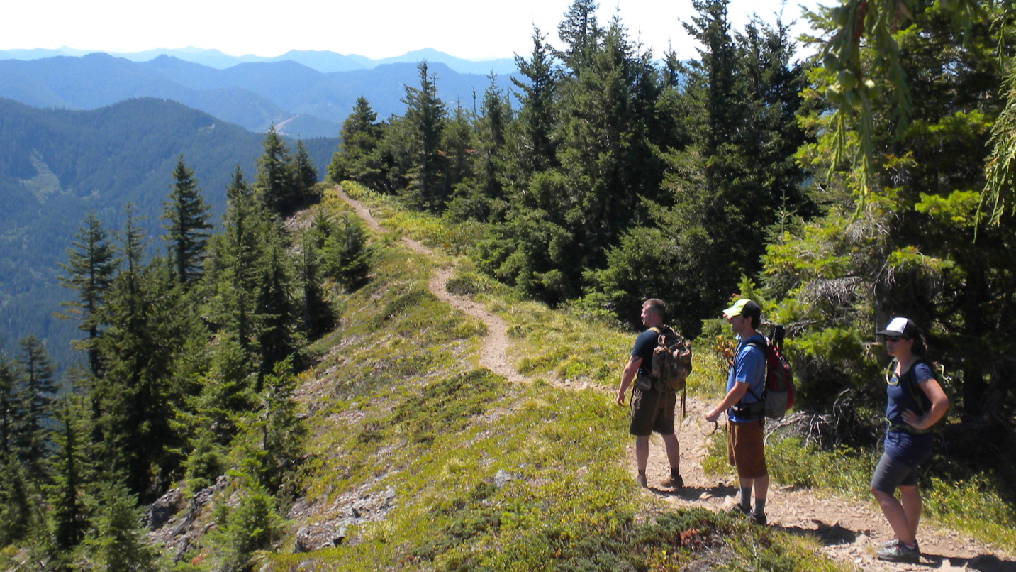
With its dense ponderosa pine forests, canyons, unique geological formations, grasslands meadows and high-desert terrain, the Ochoco National Forest is a lesser-visited destination for rugged outdoor adventurers. Over 100 miles of trail lace through the area, with routes for any level of hiker. The Steins Pillar hike is a 4-mile out-and-back through red-barked ponderosa pines and boulder fields to an uncanny spire of volcanic debris. Families enjoy the Walton Lake Trail, a flat, partially accessible route less than a mile long. Hit the 30-mile Round Mountain and Lookout Mountain Loop for a stellar backpacking trip. Or backpack the Ochoco Mountain Loop, where you’ll likely encounter more elk and deer than people. Mountain biking, rockhounding and camping are favorite pastime here, as are sno-parks in the winter.
Make your basecamp in Prineville, a growing city with several taprooms, a brewery, hotels, shops, a museum, art gallery and restaurants — from Western taverns to sushi. The city embraces its Western spirit with its annual rodeo with a stampede, and families love the city parks, splash pad, accessible fishing platform, playgrounds, and local historical monuments. Don’t miss guided stargazing and other activities at the Dark Sky-designated Prineville Reservoir State Park.
Getting There
Take Highway 26 from Madras through Prineville and the Ochoco National Forest east to John Day. From Prineville, the Ochoco Highway heads 20 miles west to Redmond, and the Crooked River Highway (Highway 27) stretches south to intersect with Highway 20. You can also book a ride on the Cascades East Transit bus, which connects Prineville to the Redmond Municipal Airport and surrounding Central Oregon communities. Charge your electric vehicle nearby at Crook County Fairgrounds, downtown Prineville, Prineville Reservoir State Park or Brasada Ranch.
When to Visit
Much of this region is part of Central Oregon’s high desert, with around 200 sunny days each year and less than 15 inches of rain. Summer days get very hot, but expect temps to drop at night. Wildfires and resulting smoke can affect the area in summer and fall months. Snowfall typically happens November through April in the upper elevations. Springtime bursts with wildflowers.
11. Willamette Adventures
Willamette Valley
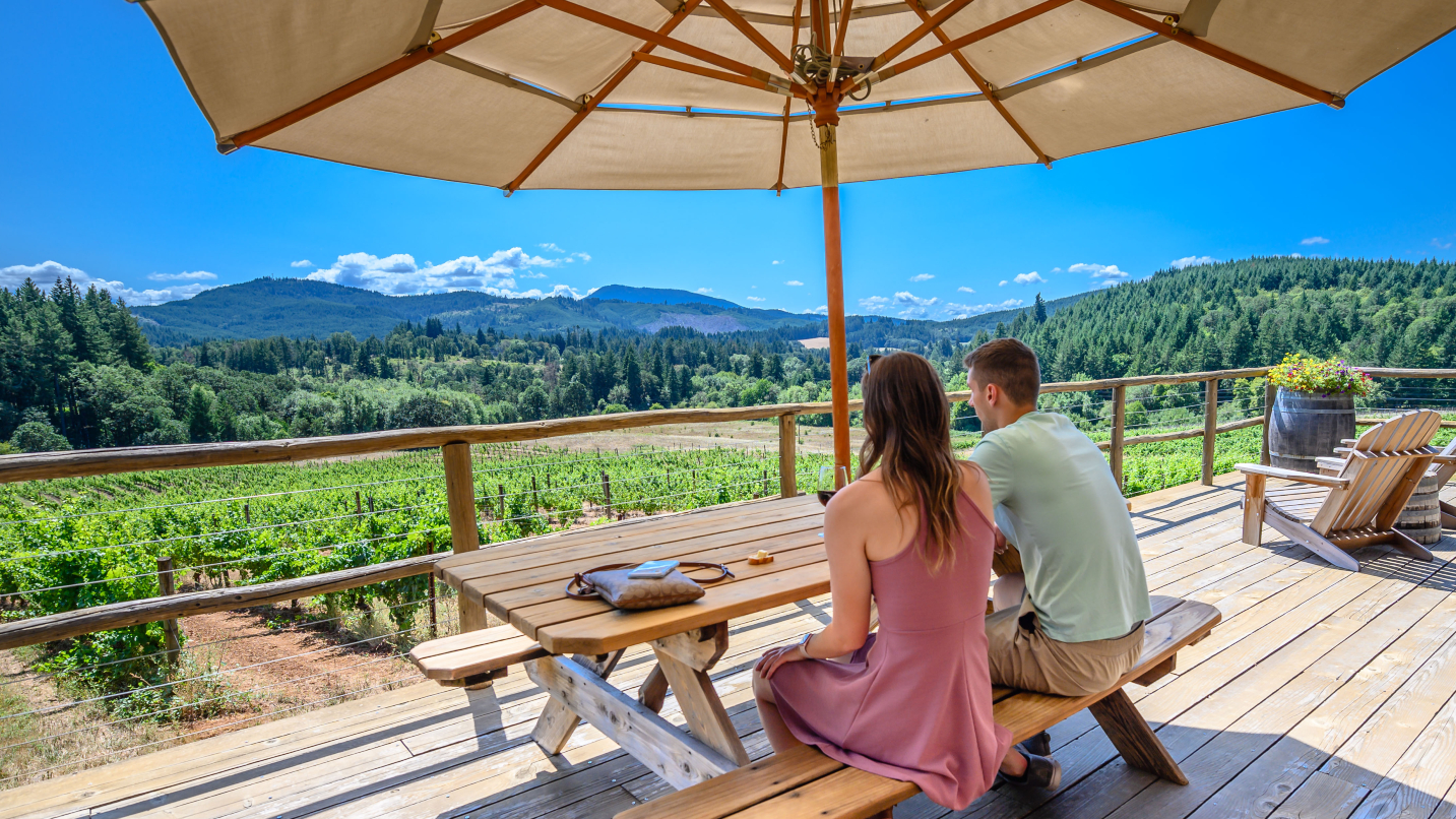
The dramatic geologic history of the North Willamette Valley — ice ages, floods, lava flows — created unique soils that conspire with the warm summers and rainy winters to create some of the finest pinot noir in the world. Of Oregon’s 18 winegrowing regions, eight are in the North Willamette Valley. But that’s not all the North Willamette Valley has to offer. This swath of wine country has pockets of natural beauty that make for great outdoor adventuring — rivers, forests, foothills, vineyards and farmland. Stroll through a valley town after a day of wine tasting and dinner, take a scenic drive and stop for some nature viewing at Miller Woods Conservation Area or Sheridan Wetlands Park.
For a lovely day hike, trails in places like Joe Dancer Park in McMinnville or Ewing Young Park in Newberg are ideal. Or head farther afield to the serene hiking routes in the forests of Our Lady Guadalupe Trappist Abbey near Carlton or the path to Niagara Falls and Pheasant Creek Falls in Siuslaw National Forest. Top-notch gravel, BMX and road cycling are big draws for cycle enthusiasts, and paddlers love to meander the Willamette Water Trail to spot wildlife and feel far from civilization. You can take a guided horseback ride through vineyards and foothills, take the family bird watching or fishing, or spend the afternoon enjoying a round of golf or disc golf. Whatever the adventure, know that this wine country region is perfectly paired with easygoing outdoor adventures.
Getting There
The North Willamette Valley covers a gorgeous expanse of Willamette Valley wine country, as well as the less-populated Coast Range foothills to the west. Highway 99W is the county’s major thoroughfare, connecting Amity in the south to McMinnville before heading northeast to Newberg — and eventually reaching Portland. Though there is no train service, Yamhill County Transit provides a network of bus options connecting neighborhoods and towns. The closest major airport is Portland International Airport (PDX), from which shuttles and rental cars can be arranged.
When to Visit
The majority of this region is characterized by a mild climate — with warm summers, chilly rainy winters and cool wind systems sourcing from the Pacific Ocean. Having four distinct seasons, there is an average of around 38 inches of rain per year, occurring mostly during the winter months.
12. High Desert Riverlands
Central Oregon
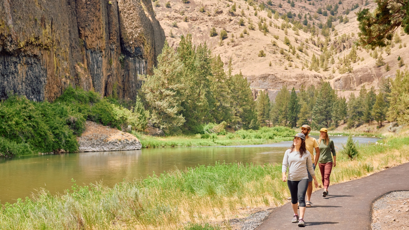
This less-traveled area of Oregon’s high desert is one of the state’s best-kept secrets. The Metolius Wild and Scenic River and Lower Deschutes Wild and Scenic River were officially designated for their untamed, undeveloped nature and cultural and recreational significance. From the banks of the Metolius at Camp Sherman, anglers cast for the famous native redband trout that thrive in the clear, cold, spring-fed waters. On the Lower Deschutes, fly fishers reel in writhing steelhead while rafters and kayakers brave thrilling rapids. On these river shores — as well as those of the Crooked River, White River and Deschutes River — campgrounds and day-use areas abound for laidback river hangs, canyonland picnics and splashing around.
Visitors to the region may immerse themselves in Indigenous culture at the Confederated Tribes of Warm Springs-owned Kah-Nee-Ta Hot Springs Resort, which offers family-friendly thermal pools, river activities and traditional salmon bakes on Saturdays for guests. Also visit the excellent Museum at Warm Springs and stop for fry bread at Twisted Teepee. The views are endless along the Journey Through Time Scenic Byway, which passes through preserved pioneer ghost towns that boomed then busted in the early 20th century. Even though campgrounds and RV parks are plentiful, and these canyonlands have an Old West vibe, modern-day amenities and luxe accommodations are definitely on offer. Stay in cabins, lodges and rental houses in Maupin, Camp Sherman, Black Butte, Lake Billy Chinook and Lake Simtustus. Many people opt to stay the night in the tiny town of Antelope, the first certified International Dark Sky Community in Oregon, for premium stargazing.
Getting There
Major highways run through Central Oregon’s Wasco and Jefferson counties. Highway 97 and Hwy 26 intersect at Madras, acting as the primary routes connecting to visitors to Portland and Bend. Highway 197 extends to the Columbia River Gorge, while Highway 20 clips southwest Jefferson County. Check conditions before driving, especially in winter. Cascades East Transit provides car-free transit to Madras and Warm Springs, with connections to Redmond Municipal Airport. Link Public Transit serves Wasco County destinations including Maupin, Wamic, Pine Hollow and Tygh Valley.
When to Visit
East of the Cascade Range, this region of Central Oregon has a semi-arid high-desert climate. Summers are hot, dry and sunny, with hot spells over 100 degrees at lower elevations. Winters are cold but not extreme, with temperatures from 35-45 degrees, with occasional cold snaps. Further toward the Cascades and high elevations, places like the Suttle Lake area have snowy winters. It’s important to check for wildfires and impacted areas during the summer months.
Tips for Visiting
- Respect the land: Wherever you go in Oregon, know that tribal nations have called these areas home since time immemorial. Stop by tribal cultural centers and museums to learn the state’s native and pioneer history and your relationship to each place.
- Secure permits: Before you head out, secure the proper permits for your wilderness area or trail — or prepare to purchase them on-site. (Some kiosks take cards, but not all.) Likewise, you can pre-purchase hunting and fishing licenses, boating and OHV permits as well as sno-park permits. Outdoor recreation maps will indicate what’s required.
- Know your abilities: Consider your group’s physical abilities and what’s realistic to do in the time you have, and in the conditions you encounter. Look to go mid-week, earlier or later in the day for fewer crowds and check TripCheck.com for the latest weather and conditions.
- Be prepared: Pack your Ten Essentials. Got the right shoes for the terrain? Plenty of water? A first-aid kit? You may not always have coverage, so take a picture of the trail map or bring one with you. Consider hiring an expert guide for a stress-free experience.
- Follow the signs: Stay on designated trails and areas to protect the landscape and keep away from dangerous areas like sheer cliff-drops. Share trails with others, and know the rules and regulations of each spot (regarding dogs, bicycles, horses, etc.). Do not stray from trails or make your own.
- Respect wildlife: If you’re lucky enough to spot wildlife, use your zoom lens and observe from afar.
- Pack it out: Don’t take anything home but your trash — and please take your trash with you, including pet waste.
- Keep Oregon green: If you plan to travel between June and October, brush up on what you need to know about wildfires, and do your part to stay safe and be respectful of Oregon’s communities and landscapes.
- Show kindness: Greet fellow adventurers and spark a conversation. Check in at a visitor center, a ranger station or local business to say hello, grab a map and pick up supplies. Support the community by eating, shopping and staying local.